Original document
GPT Image 2 · en
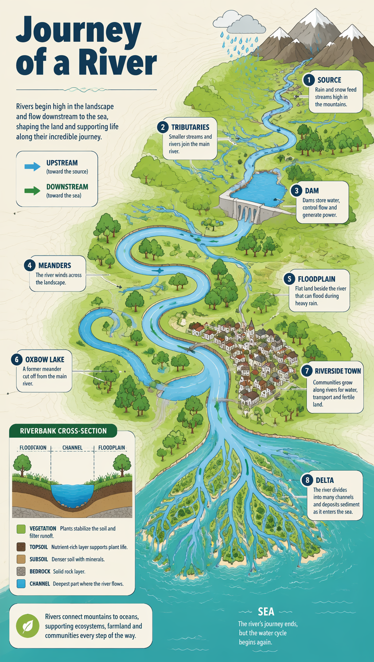
A geography infographic explaining a river system from source to sea, drawn as a top-down flowing map. Labeled features - source, tributaries, meanders, floodplain, oxbow lake and a branching delta - trace the blue river across green land into a teal ocean. Icons for rainfall, a dam and a riverside town appear along the way. Clean flat cartographic style, a fresh green-and-blue palette on cream, thin contour lines. Bold title 'Journey of a River' top-left, a small arrow legend for upstream and downstream, a cross-section inset of the riverbank.How to use
- Copy the complete original prompt, including any parameters.
- Replace the subject, text and composition with your own requirements.
- Use a compatible external tool; check its current access conditions and review the result.
Before you start
- Check whether a reference image is required. A compatible model label does not mean this example was generated with that model.
- Keep names, figures and visible text accurate; results can vary between model versions.