Original document
GPT Image 2 · en
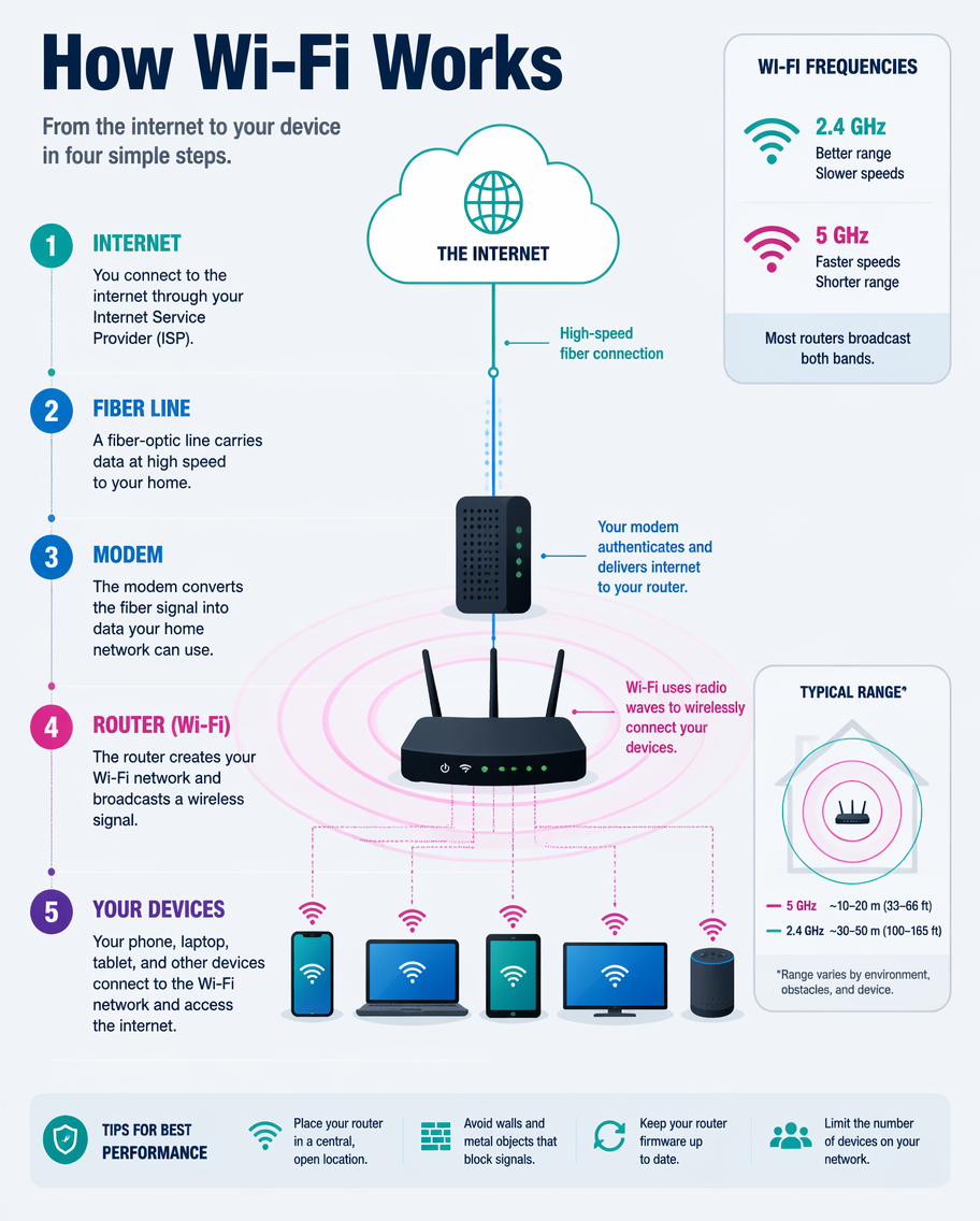
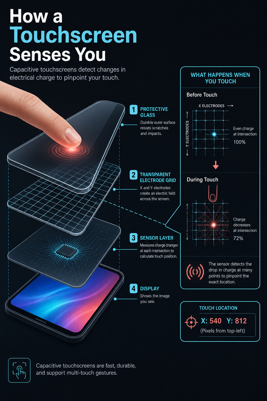
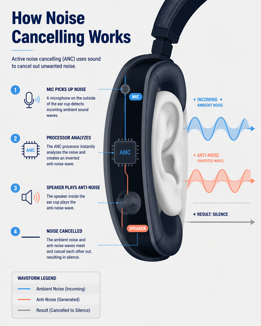
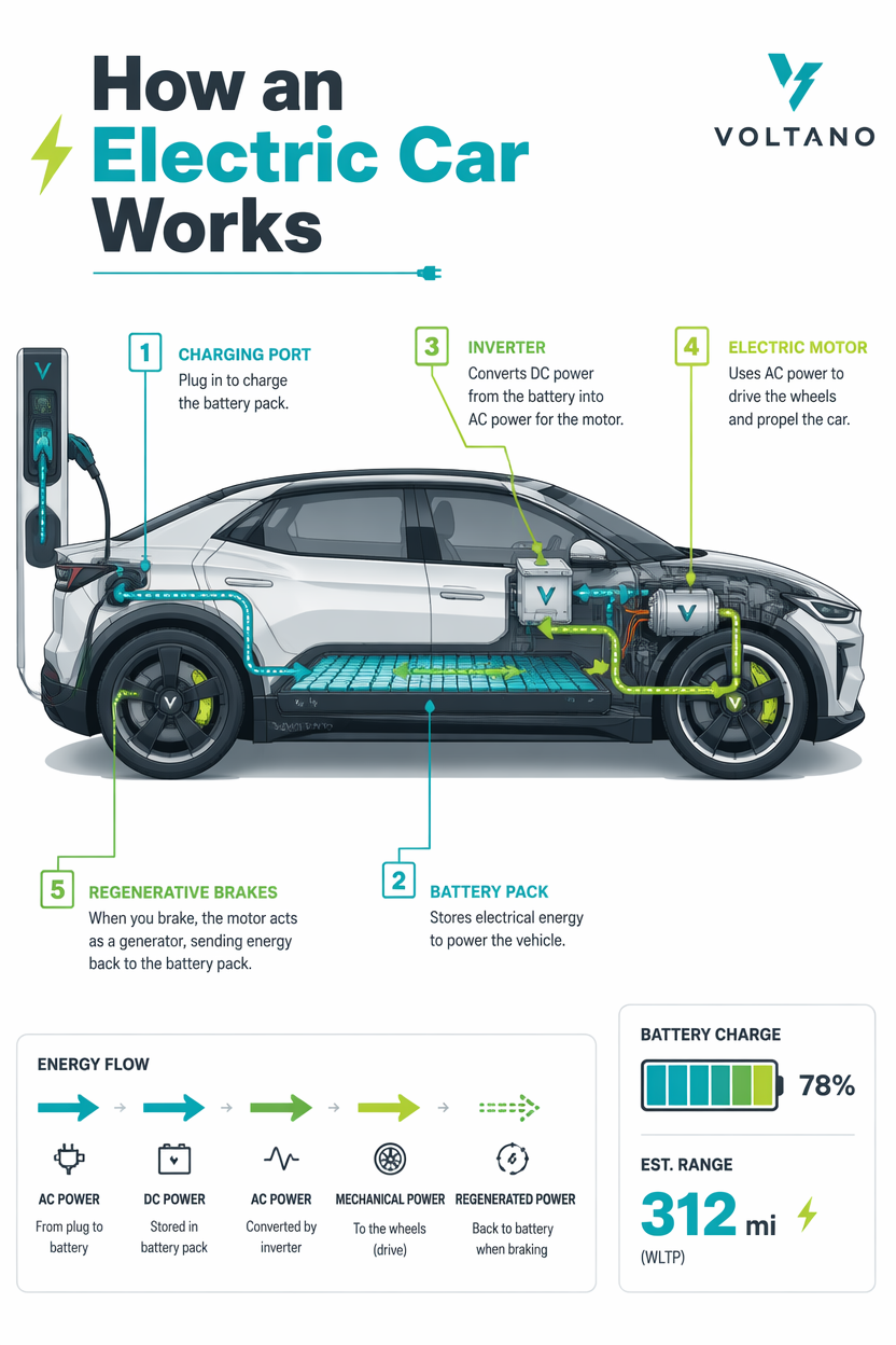
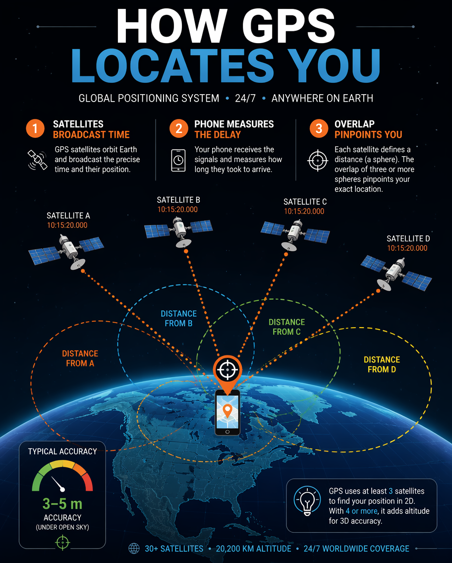
A technology infographic explaining how GPS finds your location, drawn as a scene with three or four satellites beaming signals down to a phone on a stylized globe. Dotted signal lines and expanding range circles illustrate trilateration; numbered captions explain 'satellites broadcast time', 'phone measures delay', 'overlap pinpoints you'. A space-dark background with earth-blue and orange signal accents, clean flat vector. Bold title 'How GPS Locates You' at the top, a small crosshair pin and accuracy-meter icon.How to use
- Copy the complete original prompt, including any parameters.
- Replace the subject, text and composition with your own requirements.
- Use a compatible external tool; check its current access conditions and review the result.
Before you start
- Check whether a reference image is required. A compatible model label does not mean this example was generated with that model.
- Keep names, figures and visible text accurate; results can vary between model versions.