원본 문서
GPT Image 2 · en
{
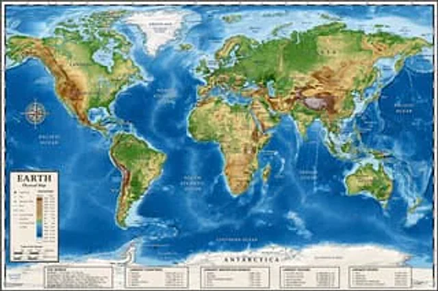
  "type": "Highly detailed cartographic world map",
  "style": "{argument name=\"color palette\" default=\"Realistic terrain and depth sounding colors\"}",
  "map_features": {
    "terrain": "The shading relief, in green, brown and white, shows mountains, valleys and plains.",
    "oceans": "Different shades of blue create varying depths of shadow; light blue represents the continental shelf, while dark blue represents the deep-sea trench.",
    "grid": "Latitude and longitude lines covering the entire map",
    "labels": "Major continents, countries, oceans, and sea areas are clearly marked in serif and sans-serif fonts."
  },
  "layout": {
    "overlays": [
      {
        "type": "Compass Rose",
        "position": "Left side of the middle, located above the Pacific Ocean",
        "description": "Classic 8-direction nautical compass"
      },
      {
        "type": "legend",
        "position": "bottom left corner",
        "title": "{argument name=\"map title\" default=\"Earth\"}",
        "subtitle": "{argument name=\"map type\" default=\"Physical map\"}",
        "contents": "Altitude color key, map symbols and distance scale"
      }
    ],
    "bottom_panels": {
      "count": 5,
      "position": "horizontal row along the bottom",
      "labels": [
        "World Overview",
        "Largest country",
        "Longest mountain",
        "Largest Ocean",
        "Longest River"
      ]
    }
  }
}
사용 방법
- 매개변수를 포함한 전체 원본 프롬프트를 복사하세요.
- 주제, 문구, 구도를 자신의 요구에 맞게 바꾸세요.
- 호환되는 외부 도구에서 사용하고 이용 조건과 결과를 확인하세요.
시작 전 확인
- 참조 이미지가 필요한지 확인하세요. 호환 표시는 해당 모델로 이 예시를 생성했다는 뜻이 아닙니다.
- 이름, 수치, 이미지 속 문구를 확인하세요. 모델 버전에 따라 결과가 다를 수 있습니다.