Original document
GPT Image 2 · en
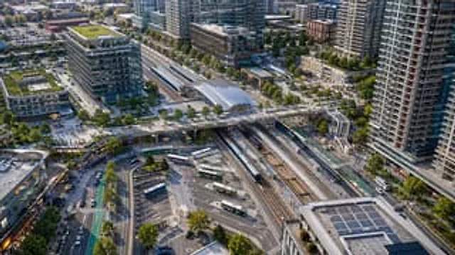
A drone aerial photograph, taken from above, showcases a modern transportation hub in a densely populated mixed-use urban area, rendered with realistic architectural detail in the clear evening sunlight. At the center of the scene is a large multi-track train station diagonally across the frame, showing six tracks, two long-distance passenger trains stopped at the platforms, and the station hall with a glass roof above. A wide pedestrian bridge spans the tracks from left to right, connecting the plazas on either side. Below, a bus hub is visible, with seven buses parked or moving through winding lanes and marked parking spaces. The station is surrounded by tall modern residential buildings, mid- to high-rise office buildings, retail stores, tree-lined streets, bike paths, sidewalks, parked vehicles, and scattered pedestrians. To the left is a striking glass office building with a green roof and a clearly visible corporate logo.{argument name="building sign text" default="innovation"} Add multiple green roofs and rooftop solar panels, especially on the building in the lower right corner. The composition should present a clean, realistic North American transit-oriented development style, using a slanted, bird's-eye view, with extremely high detail, natural colors, sharp focus, and professional urban planning photography standards, without any artistic manipulation.How to use
- Copy the complete original prompt, including any parameters.
- Replace the subject, text and composition with your own requirements.
- Use a compatible external tool; check its current access conditions and review the result.
Before you start
- Check whether a reference image is required. A compatible model label does not mean this example was generated with that model.
- Keep names, figures and visible text accurate; results can vary between model versions.